Best apps for travelling in Switzerland: the essential toolkit
What is the most essential app for travelling in Switzerland?
SBB Mobile (the Swiss Railways app) is the single most important app for any Switzerland trip. It covers trains, buses, boats, trams, and cable cars in a single real-time timetable, sells tickets, and shows live platform numbers. Download it before you land.
The best apps for Switzerland travel in 2026
Switzerland’s infrastructure is exceptionally well-digitised. The public transport system, weather service, hiking network, ski resorts, and even grocery surplus have excellent dedicated apps that make a significant practical difference to how you experience the country. The challenge is knowing which apps are worth installing and which are redundant.
This guide covers 15 apps that genuinely matter for a Switzerland trip — rated by usefulness for visitors, with honest notes on free vs paid features, iOS and Android availability, and exactly what each one does that you can’t easily do otherwise.
A general note: Switzerland has excellent mobile data coverage on 4G/5G in cities and along main valleys. Coverage drops in deep Alpine terrain — some passes and remote hiking routes have no signal. Download offline content before leaving towns.
At a glance
| Where | Works nationwide; some (SwitzerlandMobility, White Risk) are region- or activity-specific |
| Cost | Most core apps are free; a handful of premium tiers run around CHF 3-30/year |
| Time needed | 15-20 minutes to install and set up the essentials before you land |
| Getting there | Install on home wifi — some app stores geo-restrict downloads once you’re already on a Swiss network |
| Best time | Set up the day before departure so tickets and offline maps are ready on arrival |
Swiss Half Fare Card — 50% off all trains, buses & boats
Link your Half Fare Card to the SBB app and every ticket you buy is automatically calculated at 50% off. The combination makes Switzerland's public transport genuinely affordable.
- Free cancellation
- from CHF 150
1. SBB Mobile — the non-negotiable
What it does: SBB Mobile is Switzerland’s official public transport app, covering the entire integrated timetable: trains, PostBus routes, lake boats, trams, city buses, mountain railways, and cable cars. It provides real-time departures, live delay information, platform numbers, and walking directions to your platform. You can buy and store tickets directly in the app (no printing needed), link your Swiss Travel Pass or Half Fare Card for automatic discount calculation, and check seat availability on scenic trains.
Why visitors need it: Switzerland’s public transport network is one of the world’s most complex integrated systems. The SBB app is the only tool that shows the whole picture in one place — including connections between train, bus, and boat — with live data. Paper timetables cannot replicate this.
Practical notes:
- Add your departure station to Favourites on day one — you’ll check it dozens of times
- The departure board function shows the next 30+ trains from any station in real time
- Downloading your ticket to the app before entering a tunnel avoids any connectivity issues during ticket inspection
- The app works offline for tickets you’ve already downloaded; live timetables need data
Free or paid: Free. Tickets purchased through the app are at standard SBB prices — no app surcharge.
iOS + Android: Yes, both. The iOS app is notably polished.
Tip: When navigating complex connections, use the “via” function to force the app to route through a specific intermediate point. This is how you check whether a specific connection is feasible. If you’re travelling with a Swiss Travel Pass, link it in the SBB app immediately on activation — every subsequent ticket calculation will show the pass-holder price automatically.
2. SwissPass — your digital travel pass
What it does: SwissPass is the digital wallet for Swiss transport passes. If you hold a Swiss Travel Pass, Half Fare Card, Berner Oberland Pass, Tell Pass, or similar, SwissPass stores and displays them digitally. Inspectors can scan the QR code on your phone instead of requiring a physical card.
Why visitors need it: If you’ve purchased a Swiss Travel Pass or Half Fare Card, you can either receive a physical card by post (not practical for most visitors) or use the digital version via SwissPass. The digital version is immediate and always accessible.
Free or paid: Free.
iOS + Android: Yes, both.
Practical note: SwissPass and SBB Mobile are separate apps that work together. SwissPass holds the pass; SBB Mobile handles tickets and timetables. Both are worth having installed.
Book the Swiss Travel Pass — activate it in SwissPass within minutes of purchase.
3. MeteoSwiss — the most accurate Swiss weather app
What it does: MeteoSwiss is the Swiss Federal Office of Meteorology and Climatology’s official app. It provides local weather forecasts (hourly to 7-day), radar and precipitation maps, UV index, warnings for thunderstorms and heavy rain, snow forecast for mountain areas, and a pollen forecast that many visitors don’t know exists.
Why visitors need it: Weather in Switzerland — particularly in Alpine areas — is highly localised. A thunderstorm can develop over one valley while the next valley is clear. MeteoSwiss uses Switzerland’s dense network of measurement stations to provide granular, accurate local forecasts. International weather apps (Weather.com, AccuWeather) consistently underperform for Swiss Alpine conditions.
The mountain warning feature: MeteoSwiss shows specific warnings for mountain areas at different elevations. If you’re hiking above 2,000m, the forecast for the Gotthard massif is more relevant than the forecast for Andermatt town. The app distinguishes these.
Free or paid: Free. A premium version (MeteoSwiss Pro, CHF 4.99) removes ads and adds some additional features, but the free version is sufficient for travel planning.
iOS + Android: Yes, both.
Tip: Check the 72-hour radar animation (not just the forecast) before committing to a mountain pass hike or climb. It shows the actual progression of weather systems.
4. SwitzerlandMobility — hiking and cycling trails with offline maps
What it does: SwitzerlandMobility is the official app for Switzerland’s national recreational route network. It covers all 65,000km of hiking trails, 12,000km of cycling routes, 7,000km of mountain bike trails, 3,000km of inline skating routes, and the country’s paddling routes. Trail data includes difficulty, distance, elevation profile, estimated time, and connections to public transport stops. Offline map download is available by region.
Why visitors need it: Yellow hiking signposts in Switzerland give you trail time estimates and next-destination names, but they don’t show the big picture. SwitzerlandMobility shows you where you are on the trail, which junction is next, and what the alternative routes are. For planning day hikes from a base, it’s indispensable — you can filter by difficulty, starting point, and maximum elevation gain before you go.
Offline mode: This is the killer feature. Download the map tiles and trail data for a canton or region while on wifi and the app navigates you through areas with no signal.
Free or paid: Free with significant functionality. The premium version (CHF 29.90/year) adds additional offline map detail and removes advertising.
iOS + Android: Yes, both.
Link with best hikes in Switzerland: All the routes in our hiking guide are on SwitzerlandMobility — search by trail name to find the exact GPX track.
5. Hike — offline trail maps
What it does: Hike (formerly called Maps.me for outdoor use by some) is a lightweight offline trail mapping app. It downloads topographic map tiles and trail overlays for use without any data connection. Less data-heavy than SwitzerlandMobility but with good basic trail information for navigation.
Why visitors need it: As a backup to SwitzerlandMobility for deep Alpine areas with guaranteed no signal. The app is lighter on storage than full SwitzerlandMobility downloads.
Free or paid: Free with in-app purchases for specific map packs.
iOS + Android: Yes, both.
6. Komoot — route planning and community trail intelligence
What it does: Komoot is a route planning app popular with cyclists and hikers across Europe. It allows you to plan custom routes by drawing a line on the map, generates turn-by-turn navigation for hiking, road cycling, and mountain biking, and shows community-contributed photos and condition reports for specific trails and road segments.
Why visitors need it: The community intelligence is Komoot’s real value. Trail conditions, particularly on high passes and technical mountain bike routes, are reported in real time by other users. A pass shown as “open” on official sources may have a critical report from yesterday noting that 50cm of new snow fell. Komoot’s community surfaces this kind of detail that no official app provides.
Offline: Komoot uses region-based downloads (each Swiss region costs approximately CHF 3.99 one-time; Switzerland bundle available). The offline navigation is good.
Free or paid: The base app is free. Route planning with navigation requires region purchases (CHF 3.99 per region) or a Komoot Premium subscription (CHF 5.99/month or CHF 59.99/year).
iOS + Android: Yes, both.
Best use case for Switzerland: Planning multi-day cycling tours, particularly for routes like the national Veloland routes covered in our cycling guide.
7. Too Good To Go — food waste rescue and budget eating
What it does: Too Good To Go connects users with restaurants, bakeries, supermarkets, and cafes that have unsold food at the end of the day. You pay CHF 2-6 for a “magic bag” containing CHF 12-20 worth of food, collected during a specific collection window (usually 1-2 hours before closing). No guarantee of specific contents.
Why visitors need it: Swiss cities have extensive Too Good To Go coverage. Coop, Migros, Manor, and Globus food halls all participate, as do hundreds of independent restaurants, bakeries, and sushi restaurants in Zurich, Geneva, Basel, Bern, and Lausanne. For travellers on a tight budget, or anyone who wants a spontaneous meal at minimal cost, it’s genuinely useful.
Coverage in Switzerland: Zurich has the most bags available — typically 200+ visible at 17:00 on any weekday. Geneva, Basel, Bern, and Lausanne all have solid coverage. Smaller towns (St. Gallen, Fribourg, Lugano) have coverage but fewer options.
Honest note: This works well for visitors who are flexible — the collection window is specific and you don’t choose what you get. It’s not useful for those with dietary restrictions or strict plans.
Free or paid: Free. You pay per bag collected; no subscription needed.
iOS + Android: Yes, both.
8. Twint — Swiss mobile payment (honest tourist note)
What it does: Twint is Switzerland’s dominant mobile payment system, integrated into Swiss banks and accepted by almost all Swiss retailers, vending machines, parking meters, and even mountain huts. It’s linked directly to a Swiss bank account or debit card.
The honest visitor note: Twint requires a Swiss bank account or a Swiss mobile number to register. Most tourists cannot register for a standard Twint account. The “Twint prepaid” option (available through convenience stores like k kiosk) allows a limited prepaid version, but functionality is reduced compared to the full bank-linked account.
Why it’s still worth knowing about: You’ll see Twint QR codes everywhere in Switzerland. Understanding what it is — and that you probably can’t use it as a visitor — saves confusion. Switzerland is increasingly cashless in some sectors, and Visa/Mastercard are accepted almost everywhere Twint is; you’re not blocked from purchases, just from the specific Twint ecosystem.
Free or paid: Free (for registered users).
iOS + Android: Yes, both.
9. PostBus app — for remote valley connections
What it does: The PostBus (PostAuto/CarPostal) app shows timetables, departure information, and tickets for the yellow PostBus network, which serves mountain villages, rural valleys, and communities not connected to the main SBB rail network. While SBB Mobile includes PostBus timetables, the dedicated PostBus app has more granular stop-level information and is sometimes updated faster for mountain route changes.
Why visitors need it: If your itinerary includes remote areas — Appenzell, the Val Mustair, the upper Engadin’s minor valleys, Graubünden’s back roads — PostBus is how you get there. The dedicated app is more reliable for booking specific mountain PostBus routes.
Free or paid: Free.
iOS + Android: Yes, both.
Note: SBB Mobile covers most PostBus needs. Only install the separate PostBus app if you’re specifically exploring remote areas not well-represented in SBB Mobile’s stop database.
10. Skiline — live ski resort data
What it does: Skiline aggregates real-time ski resort data across the Alps. For Switzerland specifically, it shows live piste status, lift operating status, snow depth at different elevations, webcams, and forecast for over 20 major Swiss ski areas including Verbier, Zermatt, Davos, St. Moritz, Grindelwald, and Saas-Fee.
Why visitors need it: Nothing is more frustrating than arriving at a ski resort to find key lifts are closed for maintenance or the piste you came for has closed early due to warmth. Skiline’s live lift status (updated every 5-10 minutes during operating hours) allows you to plan your day on the mountain before leaving the hotel.
Additional feature: Skiline tracks your skied distance, vertical metres, and lifts taken — useful if you want to compare resort performance or simply know how far you skied.
Free or paid: Free with premium features (CHF 3.99/year for detailed statistics and more resort data).
iOS + Android: Yes, both.
Link: See also our best ski resorts in Switzerland guide for season dates, lift systems, and snow records.
11. Outdooractive — multi-sport activity platform
What it does: Outdooractive is a European outdoor activity platform with strong Swiss content. It has hiking, cycling, mountain biking, climbing, ski touring, and snowshoeing routes, community reviews, and offline maps. The Swiss content is particularly well-curated, with many routes contributed by Swiss mountain clubs (SAC).
Why visitors need it: For hikers who want more than SwitzerlandMobility’s functional interface, Outdooractive provides richer community content and better integration of Alpine Club (SAC) route data, including technical difficulty ratings for alpine scrambles and via ferratas.
Free or paid: Free with limited downloads. Premium (CHF 2.99/month) required for extensive offline map use.
iOS + Android: Yes, both.
12. White Risk — avalanche bulletin (SLF)
What it does: White Risk is the avalanche safety app from the WSL Institute for Snow and Avalanche Research (SLF). It shows the Swiss avalanche bulletin, which is published twice daily during winter (December to April/May). The bulletin maps danger levels (1-5) across different aspects and elevations of the Swiss Alps, with specific warnings for problem types (wind slab, persistent weak layer, wet avalanche).
Who needs it: Anyone planning off-piste skiing, ski touring, snowshoeing outside marked routes, or winter hiking above the tree line in any Swiss Alpine area. The avalanche bulletin is the primary safety tool for winter mountain travel.
Free or paid: Free.
iOS + Android: Yes, both.
This is not optional: If you are going off-piste or ski touring in Switzerland, check White Risk every day before leaving. Avalanche danger changes daily with temperature, wind, and new snow. The information is free, authoritative, and can save your life.
13. My Swiss Outdoor / Avalanche.report
What it does: My Swiss Outdoor aggregates Swiss outdoor data including the SLF avalanche bulletin, MeteoSwiss mountain forecasts, and Swiss Alpine Club (SAC) mountain hut information in a single interface. Avalanche.report is a companion app specifically for the avalanche bulletin, showing the data in a format slightly cleaner than White Risk.
Free or paid: Free.
iOS + Android: Yes, both.
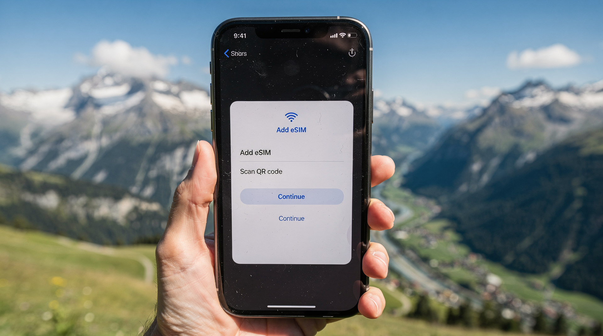
14. Airalo — eSIM for data connectivity
What it does: Airalo is an eSIM marketplace that sells data plans from local and regional operators without requiring a physical SIM card. For Switzerland, relevant plans include Swiss operators (Sunrise, Swisscom, Salt) or European regional plans that cover Switzerland alongside the EU.
Why visitors need it: Switzerland is not in the EU and EU roaming rules do not apply here. This means your EU mobile plan may incur roaming charges in Switzerland (check with your provider). Swiss operators charge for data at Swiss rates — typically CHF 10-20/day for roaming top-ups depending on your home provider.
An eSIM for Switzerland: A 10GB Switzerland-only data plan from Airalo costs approximately USD 12-16. A European regional plan covering Switzerland plus EU countries costs slightly more but is better value if you’re also travelling through France, Germany, or Italy.
Alternatives:
- Buy a Swiss SIM on arrival at Zurich or Geneva airport (Sunrise and Salt have kiosks; Swisscom is in most post offices). A 10GB SIM costs CHF 20-35.
- The Swisscom, Sunrise, and Salt apps all sell digital prepaid options if you have an unlocked phone with eSIM support.
Free or paid: The app is free; you pay for data plans. Plans start from USD 4.50 for 1GB.
iOS + Android: Yes, both (eSIM requires compatible hardware — check if your phone supports eSIM before relying on this option).
Link: See also our eSIM and internet guide for a full breakdown of connectivity options in Switzerland.
15. Google Maps — still useful, but know its limits
What it does: Google Maps covers Switzerland’s public transport network with reasonable accuracy, including train and bus connections. Walking and cycling directions are good. Restaurant and attraction information is comprehensive.
Why it’s not your primary Switzerland app: Google Maps public transport data in Switzerland is notably less accurate than SBB Mobile. It misses some rural PostBus connections, occasionally shows incorrect platform numbers, and does not display real-time delay information as reliably as the official SBB system. For navigation in cities and finding specific restaurants or shops, Google Maps is excellent. For planning train journeys, always cross-reference with SBB Mobile.
Offline maps: Download Switzerland offline maps (Settings → Offline maps → Switzerland) before travelling. The offline navigation for driving and walking is reliable.
Free or paid: Free.
iOS + Android: Yes, both.
Your app setup checklist before arriving in Switzerland
Essential (install before you land):
- SBB Mobile — public transport everything
- MeteoSwiss — daily weather check
- SwitzerlandMobility — hiking and cycling (if relevant to your trip)
- Google Maps with Switzerland offline download
Recommended for most visitors:
- SwissPass — if you have a travel pass
- Too Good To Go — for budget eating in cities
- Komoot or Outdooractive — if hiking or cycling is a focus
Situational:
- Skiline — winter skiing trips
- White Risk — any off-piste or ski touring
- Airalo — if your home plan charges for Swiss roaming
- PostBus — remote valley exploration
Connectivity note: Switzerland’s 5G coverage from Swisscom and Sunrise reaches all cities and most major valleys. Even at altitude, the Swisscom network is surprisingly good on many cable car lines and mountain restaurants (they maintain masts on several summits). You will lose signal in tunnels and deep gorges — the SBB app handles this gracefully by showing cached timetable data.
Planning your Switzerland trip digitally
Switzerland’s digital infrastructure rewards preparation. Downloading maps and tickets before leaving wifi reduces anxiety on the mountain and keeps you moving efficiently. The SBB app combined with the Swiss Travel Pass is the stack that makes Switzerland’s famously complex public transport feel effortless.
For a full planning framework, see our Switzerland trip planning guide and the first-time visitors guide. If you’re planning a hiking trip, the best hikes guide has SwitzerlandMobility trail numbers for each route.
Book the Swiss Half Fare Card and link it to SBB Mobile — the combination cuts every train ticket price by 50% and takes about three minutes to set up.
For understanding the currency, tipping customs, and how to pay for things in Switzerland generally, see our currency and tipping guide.
Apps that overlap: what to actually delete
Several apps on this list cover similar ground, and installing all of them creates clutter rather than convenience. SBB Mobile already includes most PostBus timetables — only add the dedicated PostBus app if you’re deep in a rural valley like Appenzell or the back roads of Graubunden. Google Maps and SwitzerlandMobility both do trail navigation, but only one gives yellow-signpost time estimates that match what you’ll see on the ground — that’s SwitzerlandMobility. My Swiss Outdoor and White Risk both surface the SLF avalanche bulletin; keep White Risk and skip the other unless you also want SAC hut booking data in the same place.
For city-based trips without mountain days — a long weekend in Zurich or Geneva, for example — SBB Mobile, MeteoSwiss, and Google Maps cover essentially everything you need. Add the rest only as your itinerary requires them.
Data and battery: practical setup before you land
Switzerland’s mountain terrain is hard on both data connections and battery life — screens stay on longer when you’re checking timetables or trail maps in bright alpine light. Set your phone to download Google Maps’ offline Switzerland tiles and SwitzerlandMobility’s regional map packs on wifi before departure, not on arrival; some app stores restrict large downloads over a Swiss mobile connection. If your home carrier charges heavily for roaming, compare the on-arrival SIM option at Zurich or Geneva airport against an eSIM purchased in advance — the eSIM route means your phone is already working the moment you land, useful if your first stop is a train connection with a tight platform change.
Frequently asked questions about Best apps for travelling in Switzerland
Do I need a Swiss SIM card if I already have SBB Mobile and MeteoSwiss installed?
You need some form of data connection to use these apps in real time (though SBB Mobile stores downloaded tickets offline). Options include a Swiss SIM bought on arrival, an eSIM purchased in advance through a marketplace like Airalo, or your home carrier’s roaming plan — check charges before relying on roaming, since Switzerland is outside the EU and not covered by EU roaming rules. See the eSIM and internet guide for a full comparison.
Can I use these apps without a Swiss phone number?
Yes, with one exception: Twint (mobile payments) typically requires a Swiss bank account or number to register fully. SBB Mobile, MeteoSwiss, SwitzerlandMobility, SwissPass, and the other apps on this list work with any phone regardless of home country or number.