Hikes in the Lauterbrunnen Valley: the complete trail guide
What are the best hikes in Lauterbrunnen?
The hike up to Mürren via Gimmelwald (3 hours) and the path to the Schynige Platte ridge are the best full-day hikes. The Staubbach Falls and Trümmelbach Falls are unmissable short walks from the valley floor, accessible to all.
Lauterbrunnen: Switzerland’s most dramatic valley
The Lauterbrunnen Valley is one of the great natural theatres of Europe. A deep U-shaped glacial valley cut into the Bernese Oberland, it is flanked on both sides by vertical cliffs rising 300-400 metres from the valley floor, over which pour 72 named waterfalls. The valley name means “many springs” in old German — an understatement for a place where water cascades from the cliff tops in every direction.
Above the valley walls, connected only by cable car and rack railway, sit the two famous car-free villages of Mürren and Wengen. Beyond them rise the Eiger, Mönch, and Jungfrau — the defining peaks of the Bernese Oberland. The visual drama is extreme and the walking possibilities exceptional, from short accessible paths to the valley floor to demanding ridge traverses requiring a full day of effort.
This guide covers the best hikes in and around the Lauterbrunnen Valley, from the easiest walks accessible to all ages to the more demanding routes that reward greater effort.
Getting to Lauterbrunnen
Lauterbrunnen is reached by train from Interlaken Ost (20 minutes) — a journey that gives the first glimpse of the valley walls through the carriage window. The Swiss Travel Pass covers this connection. From Lauterbrunnen, connections proceed by:
- The Wengernalpbahn (rack railway) to Wengen, Kleine Scheidegg, and the Jungfrau
- The cable car from Grütschalp to the Mürren direction (ferry across the valley, then narrow-gauge railway to Mürren)
- The Schilthornbahn cable car from Stechelberg (at the valley head) to Gimmelwald, Mürren, Birg, and Schilthorn
All of these transport services are covered or discounted by the Swiss Travel Pass.
Staubbach Falls and valley floor walk
Distance: 3km | Elevation gain: 50m | Time: 1 hour | Difficulty: Easy
The Staubbach Falls drop directly from the cliff above Lauterbrunnen village — a free-falling cascade of 297 metres that Goethe immortalised in his 1779 poem “Gesang der Geister über den Wassern.” The falls are visible from anywhere in the lower valley but can be approached closely on a short trail from the village.
A path climbs from behind the church in Lauterbrunnen to a viewpoint behind the falls where the spray soaks all comers on windy days. The sensation of standing in the mist below 300 metres of falling water is remarkable. Allow 30 minutes return.
Beyond the falls, the valley floor walk from Lauterbrunnen toward Stechelberg (the valley head) is a gentle 5km trail through meadows flanked by the cascading walls. In July and August, the meadow wildflowers are exceptional — this is one of the botanically richest valley floors in the Alps, with orchids, gentians, and alpine roses growing among the grass.
Trümmelbach Falls
Distance: 0.5km | Elevation gain: 150m (by lift) | Time: 1.5 hours | Difficulty: Easy
Trümmelbach Falls is one of the most extraordinary natural features in the Alps — a series of ten glacial waterfalls inside a mountain, accessible by a tunnel lift cut through the rock. The Trümmelbach drains the glacial meltwater from the Eiger, Mönch, and Jungfrau glaciers above, and at peak melt (June-August) carries up to 20,000 litres per second through the narrow rock channels.
The sound inside the gorge is extraordinary — a continuous roar that vibrates through the stone underfoot. The spray from the falls and the narrowness of the passages make this one of the most visceral natural experiences in Switzerland. The viewing platforms are well-secured and the route is not physically demanding, though the noise and spray can unsettle younger children.
Practical details: Open April-November, daily 09:00-17:00 (July-August until 17:30). Adults CHF 14, children CHF 7. Located 3.5km from Lauterbrunnen village — walk or take the PostBus from Lauterbrunnen. Not covered by the Swiss Travel Pass for entry, but the bus is covered. You can book Trummelbach Falls admission tickets in advance to skip the queue during peak season.
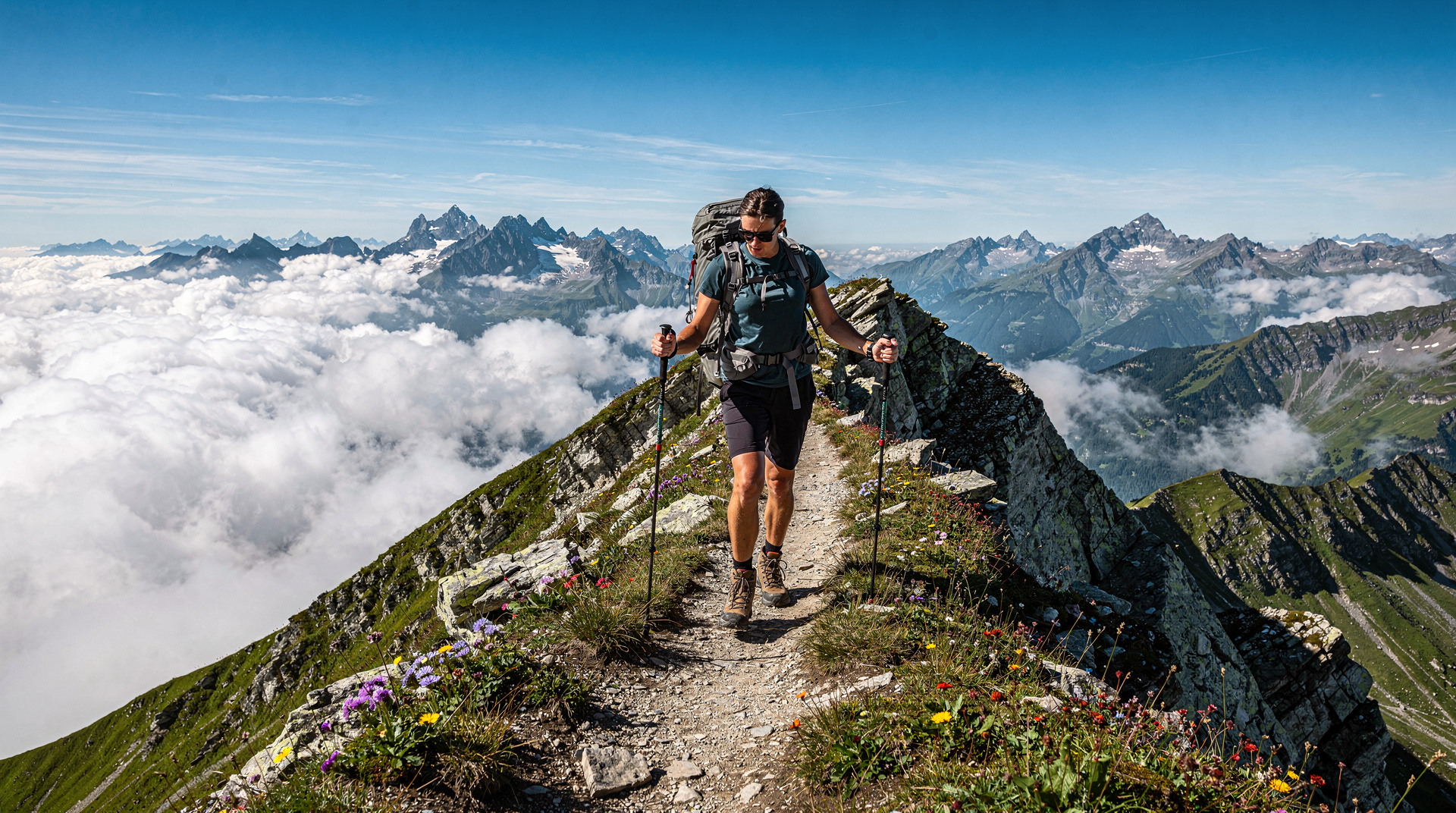
Walk to Mürren via Gimmelwald
Distance: 8km (one way) | Elevation gain: 700m | Time: 3 hours | Difficulty: Moderate
The classic approach to Mürren on foot from the valley floor is one of the great walks in the Bernese Oberland. From Lauterbrunnen, take the cable car to Grütschalp (the ferry-cable car crossing above the valley) and walk the narrow-gauge railway line direction to Mürren, or take the more dramatic approach: walk from Stechelberg up the path to Gimmelwald, then continue on the cliff-edge trail to Mürren.
The Stechelberg to Gimmelwald section (about 2 hours) ascends steeply through forest and then farm land to the tiny hamlet of Gimmelwald (1,363m), clinging to the edge of the cliff above the valley. The views from Gimmelwald across to the opposite wall and down the valley are extraordinary. From Gimmelwald, the trail continues more gently along the cliff edge to Mürren (1,638m), with the Eiger, Mönch, and Jungfrau visible across the valley the entire way.
Mürren is a car-free village and the departure point for the Schilthornbahn cable car to Birg and Schilthorn. The village has several good restaurants for lunch. Return to Lauterbrunnen via cable car from Mürren to Stechelberg (discounted with Swiss Travel Pass), or continue the Schilthorn Panorama Trail ridge walk (see the best hikes guide for this).
The Schynige Platte ridge walk
Distance: 12km (to Faulhorn return via rack railway) | Elevation gain: 600m | Time: 5 hours | Difficulty: Moderate-demanding
The Schynige Platte (1,967m) above Wilderswil is one of the classic Bernese Oberland viewpoints, reached by the historic Schynige Platte Bahn rack railway (covered by the Swiss Travel Pass) from Wilderswil. The ridge running from Schynige Platte toward the Faulhorn (2,681m) offers sustained panoramic views combining the full Jungfrau massif to the south with the lakes of Thun and Brienz to the north.
The walk from Schynige Platte to the Faulhorn summit takes about 3.5 hours with 600m of ascent. The Faulhorn Hotel at the summit is one of the oldest mountain guesthouses in Switzerland (1832) and serves simple meals on the terrace with the most extraordinary view of any restaurant in the Bernese Oberland.
Continue from Faulhorn to the Bachalpsee and down to Grindelwald First cable car for the most satisfying full-day extension — this is the first 16km of the famous Faulhorn ridge traverse described in the best hikes guide.
Getting there: Train from Lauterbrunnen or Interlaken to Wilderswil, then rack railway. Swiss Travel Pass covers transport.
Wengen panorama walk
Distance: 8km loop | Elevation gain: 300m | Time: 3 hours | Difficulty: Easy
Wengen, the car-free village on the eastern wall of the Lauterbrunnen Valley, has an extensive network of prepared walking trails through its surrounding farmland and forest. The Wengen panorama walk circles the village plateau on marked trails, always with views across the valley to Mürren and the cliffs beyond.
A particularly good section runs from Wengen toward Wengernalp (2,064m) on a trail parallel to the rack railway, with the Eiger progressively filling the sky. The Wengernalp is the departure point for the Männlichen to Kleine Scheidegg traverse (the easiest great walk in Switzerland — see the easy hikes guide).
Valley floor to Stechelberg
Distance: 9km one way | Elevation gain: 100m | Time: 2.5 hours | Difficulty: Easy
The walk from Lauterbrunnen to the valley head at Stechelberg on the valley floor trail is gentle and continuously beautiful. The path passes through meadows, alongside the Weisse Lütschine river, under the overhanging cliff walls with waterfalls descending from above, and through the hamlet of Isenfluh. Birdsong from the river, the sound of cowbells from the higher meadows, and the distant roar of the Trümmelbach create a soundscape as distinctive as the visual landscape.
This walk is accessible to any fitness level and makes an excellent way to spend a morning or afternoon between transport connections. It is particularly rewarding in early morning (before 09:00) when the valley mist has not yet lifted and the waterfalls emerge from the cloud above.
Return from Stechelberg by PostBus (covered by Swiss Travel Pass) to Lauterbrunnen.
Winteregg and the cliff path
Distance: 6km (Mürren to Winteregg loop) | Elevation gain: 200m | Time: 2.5 hours | Difficulty: Easy-moderate
The path from Mürren to the hamlet of Winteregg follows the edge of the cliff above the valley with unobstructed views across to the Wetterhorn and the Jungfrau massif. This section of cliff-top path, well away from the main tourist trails between Mürren and the Schilthorn cable car, is quieter and more intimate than the main routes.
The return to Mürren can be made directly or extended through the forest below Winteregg on the lower path.
Practical advice for hiking in Lauterbrunnen
Weather windows: The Lauterbrunnen Valley frequently fills with cloud and valley fog, particularly in the morning. Checking the valley floor conditions from Wengen or Mürren above gives a clear picture of whether conditions in the valley are improving or deteriorating. In summer, mornings and evenings are generally better than midday for extended walks.
Crowds: The Lauterbrunnen Valley is one of the most visited areas in Switzerland. The main tourist sites — Staubbach Falls, Trümmelbach Falls — are busy from late morning through mid-afternoon in summer. Start early or visit in the late afternoon. The higher trails (Wengen, Mürren, Schynige Platte) are significantly less crowded than the valley floor.
Accommodation: Wengen and Mürren are excellent bases for multi-day hiking in the area. Both are car-free and have accommodation in every price range. Lauterbrunnen itself is cheaper and well-connected, though the valley floor location means less morning sun in winter.
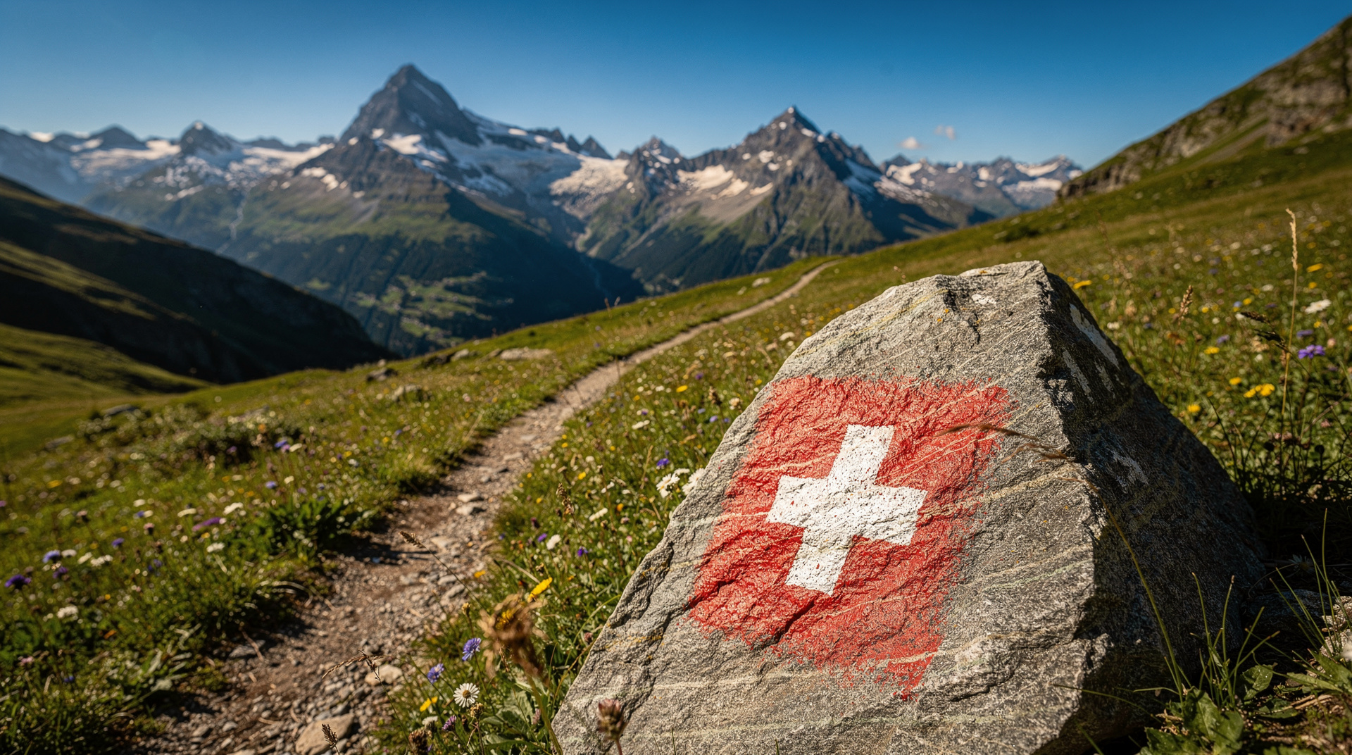
Swiss Travel Pass logistics: The pass covers Lauterbrunnen-Wengen-Kleine Scheidegg on the Wengernalpbahn, the Schynige Platte Bahn from Wilderswil, and all PostBus services in the valley. The Schilthornbahn cable cars and the Jungfraujoch journey require separate tickets (though significant pass discounts apply). See the Swiss Travel Pass guide for the full coverage details.
Seasonal timing: The best hiking conditions run from late June to early October. July is peak flower season on the high meadows. September has excellent visibility and cooler temperatures for walking. Best time to visit Switzerland covers seasonal conditions in detail.
For family hiking with young children, the valley floor walk and Staubbach Falls approach are the most accessible. Older children (from age 8-10) can manage the Mürren approach via Gimmelwald with appropriate pace. The easy hikes guide covers the Männlichen to Kleine Scheidegg trail, which is within reach of the Lauterbrunnen Valley and ideal for mixed-ability groups.
What makes the Lauterbrunnen Valley special
The Lauterbrunnen Valley’s uniqueness among Swiss landscapes comes from a combination of geological factors that are worth understanding to fully appreciate what you are seeing. The U-shape of the valley is the signature of glacial carving — the glacier that occupied this valley during the last Ice Age was several kilometres thick and carved the valley walls into the sheer vertical faces visible today. The waterfalls emerge where smaller tributary valleys (hanging valleys) were left suspended above the main valley floor after the glacier retreated.
The 72 waterfalls that give the valley its character are fed by a combination of glacial meltwater from the high peaks (Staubach, Mürrenbach), spring water emerging from the limestone bedrock (several falls are fed by underground rivers), and seasonal snowmelt. Flow rates change dramatically through the year — June sees maximum flow as the winter snowpack melts rapidly, while October may see some falls reduced to a trickle after a dry summer.
Byron, Goethe, Mendelssohn, Turner, and later Tolkien (who based Rivendell in The Lord of the Rings partly on sketches made in the valley) all found inspiration here. The valley’s combination of scale, light, and the constant presence of water creates an atmosphere that is genuinely distinct from other Swiss mountain landscapes.
Accommodation in the Lauterbrunnen area
Lauterbrunnen village: The valley floor village has a range of accommodation from campsites (some of Europe’s most scenic, looking up at the Staubbach Falls from their pitches) to mid-range hotels. It is the cheapest base in the area and well-connected by train.
Wengen: A car-free village at 1,274m on the east wall, with more expensive accommodation and a quieter, more Alpine atmosphere. Excellent for extended stays with daily excursions.
Mürren: Accessed by cable car from Stechelberg. The quietest and most authentically traditional of the three bases. Accommodation is limited — book well in advance. The village is small enough that there is no nightlife to speak of, which is either a limitation or a feature depending on your priorities.
Gimmelwald: A tiny hamlet between Stechelberg and Mürren, accessible by the same cable car. Rickety guesthouses and a community of long-term travellers who discovered it in the 1970s and couldn’t leave. Rick Steves’ travel guides have immortalised Gimmelwald as Europe’s most hidden village; the secret is well and truly out, but it remains uncommercialised.
Best times and days for Lauterbrunnen
Early morning: The valley floor is often in shadow until mid-morning, while Wengen and Mürren above already have sunshine. Starting from Wengen or Mürren early gives the best light on the peaks.
Midday: The valley floor becomes busy in summer at the main tourist sites. The waterfall trails are at their most crowded between 11:00 and 15:00.
Late afternoon: Light returns to the valley floor around 16:00 in summer, and the crowds thin from mid-afternoon. The path to Staubbach Falls in late afternoon light, with the spray catching the sun, is one of the valley’s best photographic moments.
Weekdays vs weekends: Lauterbrunnen is significantly busier on summer weekends, particularly from the Bernese and Zurich urban areas. Arriving mid-week gives a meaningfully different (quieter) experience.
June: Peak waterfall flow as the snow melts. Alpine flowers beginning in the upper meadows. Long evenings.
September: Lower crowds, excellent clarity, start of autumn colour in the forest. Waterfall flows reduced but still impressive. Best overall balance of conditions for the Lauterbrunnen hikes.
For the complete context of hiking in the Bernese Oberland beyond Lauterbrunnen, the best hikes guide and the Grindelwald First activities guide cover adjacent areas. The winter hiking guide describes the Wengen and Mürren areas in their winter character.
Flowers of the Lauterbrunnen Valley
The botanical diversity of the Lauterbrunnen Valley is extraordinary even by Swiss standards. The combination of the valley’s humidity (from the constant water falling from the cliff tops), the varied altitude range, and the traditional mowing practices maintained on the valley floor meadows creates conditions for an exceptional diversity of alpine plant species.
Key flowering seasons:
- May-June: The valley floor meadows explode with orchids, cowslips, and early spring flowers as snow retreats from the lower elevations. The Lauterbrunnen valley floor meadows are among the best wild orchid habitats in the Bernese Oberland.
- June-July: At the higher elevations around Wengen and Mürren, alpenroses (Rhododendron ferrugineum) colour the slopes pink-red. Blue gentians, yellow arnica, and white wood anemones are among the most visible species. The meadows around Schynige Platte are botanically exceptional.
- July-August: The high alpine meadows above 2,000m are at peak flower density. Edelweiss (Leontopodium alpinum) grows on the limestone rock faces above the treeline.
The Schynige Platte Alpine Garden: The rack railway station at Schynige Platte includes a maintained Alpine Garden (open June to September) containing over 600 species of alpine plants from across the Alps, labelled and arranged by region. It is one of the finest collections in Switzerland and free to enter with the Schynige Platte Bahn ticket (covered by the Swiss Travel Pass).
Photography in the Lauterbrunnen Valley
The photographic opportunities in the Lauterbrunnen area are among the most concentrated in Europe:
Staubbach Falls: The light effects in the falls’ spray create rainbow arcs in the late morning sun (typically 10:00-12:00 on sunny days). The angle changes rapidly — a 20-minute window of optimal rainbow light is followed by harsh direct sun.
Trümmelbach Falls interior: The narrow rock passages and the backlighting from outside through natural gaps in the rock create unusual and dramatic image possibilities. A wide-angle lens (16-24mm) captures the scale of the internal gorge.
Eiger from Wengen and Mürren: The Eiger north face is visible from both high villages and changes character dramatically with light and weather. The north face catches morning alpenglow from Wengen’s east-facing position; from Mürren, directly opposite, the face is in shade until midday but then catches warm afternoon light.
Waterfalls and long exposure: The many waterfalls visible from the valley floor are excellent subjects for long-exposure photography on a tripod, softening the water into silk while the cliff walls remain sharp. Early morning or overcast conditions eliminate harsh shadows.
Cattle and Alpine culture: The Lauterbrunnen Valley maintains traditional cattle farming on its meadows. Working farms, cattle in the meadows with bells, and traditional wooden farm buildings are photographic subjects that document a living cultural landscape.
Beyond hiking: other activities in the Lauterbrunnen area
The Lauterbrunnen Valley is a full activity destination beyond its hiking:
Via Ferrata: The Mürren Via Ferrata above the valley is one of the most spectacular in the Bernese Oberland. Guided tours available from the Mürren mountain sports centre. See the adventure parks guide for the broader context of Via Ferrata in Switzerland.
Paragliding: Tandem paragliding from Mürren or Männlichen is a popular activity — the Lauterbrunnen Valley provides a dramatic landing area with the cliff walls visible throughout the flight.
Mountain biking: The lower valley trails and the connections between Grindelwald and the Lauterbrunnen area are increasingly developed for mountain biking, with downhill trails accessible from the lift system.
Swimming: The Weisse Lütschine river through the valley is cold (glacial melt) but swimmable in the deeper pools. Several spots near Lauterbrunnen village are used for swimming in hot summer weather.
For family visits to the Lauterbrunnen area, the combination of Trümmelbach Falls, the valley floor walk, and an afternoon at the Mürren or Wengen playgrounds creates a full day accessible to children of all ages.