Easy hikes in Switzerland with stunning views
What are the easiest hikes in Switzerland with great views?
The Männlichen to Kleine Scheidegg trail is almost flat and offers Eiger views throughout. The Five Lakes Walk in Zermatt has minimal elevation gain for its spectacular scenery. The Bachalpsee from Grindelwald First is another excellent easy option.
Switzerland without the steep climbs
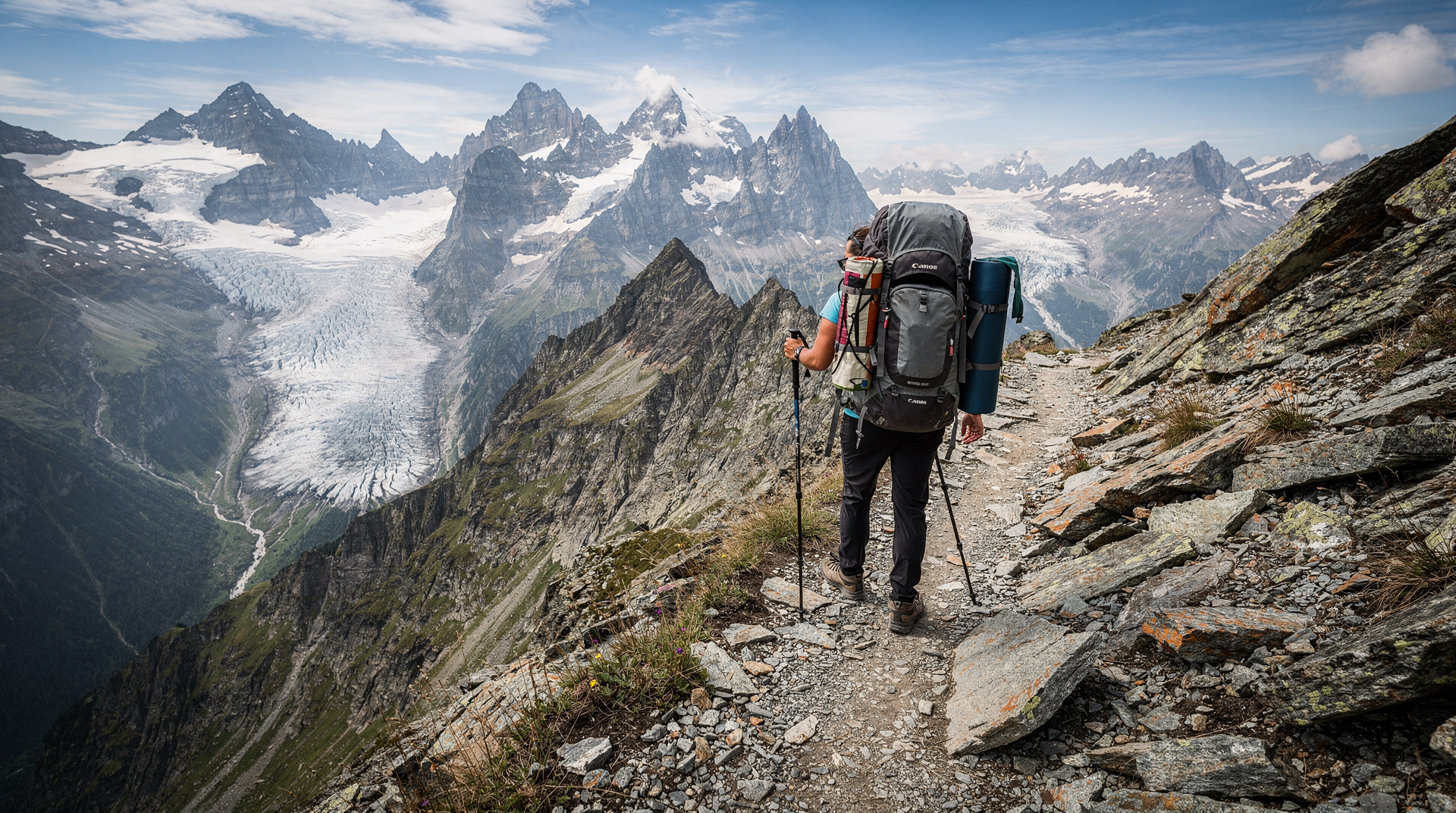
One of Switzerland’s many hiking strengths is the accessibility of its best scenery. Because the mountain transport network — cable cars, funiculars, rack railways — deposits walkers at altitude, the dramatic views that reward hard effort in other countries are often reachable in Switzerland with a short, easy walk from a cable car station.
This guide focuses on walks where the difficulty is genuinely low — elevation gains under 400 metres, paths in good condition, no scrambling or technical terrain — but the rewards are high. Each route is accessible to reasonably active adults and most of them are suitable for children aged 6 and above.
The Swiss Travel Pass covers most transport to the trailheads listed here, including rail to the main valley stations. Cable car surcharges are separate but often discounted for pass holders.
Männlichen to Kleine Scheidegg: the easiest great hike
Distance: 6km | Elevation gain: 70m | Time: 1.5-2 hours | Difficulty: Easy
This is the benchmark easy walk in Switzerland — almost entirely flat or gently descending, with the Eiger north face directly in front for the entire two hours. The route runs along the wide ridge between the Männlichen summit (2,343m) and Kleine Scheidegg (2,061m), one of the most celebrated mountain viewpoints in the Alps.
Reach Männlichen by gondola from Grindelwald (the longest gondola in Europe at 6.2km) or by cable car from Wengen. Walk the prepared trail to Kleine Scheidegg. Return to Grindelwald or Wengen by the Wengernalpbahn rack railway, covered by the Swiss Travel Pass.
The Eiger, Mönch, and Jungfrau face you throughout the walk. In late spring (June), the meadows along the trail are carpeted with alpine wildflowers. The walk can be extended upward to the Männlichen peak (add 30 minutes) for a 360-degree panorama that adds the Bernese Oberland to the south and the Bernese Mittelland to the north.
What to bring: The altitude (above 2,000m) means cooler temperatures than the valley even in midsummer. Carry a light jacket. The route is exposed — bring sunscreen and sunglasses. Water is available at Männlichen (restaurant) and at Kleine Scheidegg.
Five Lakes Walk (Fünfseen-Wanderung), Zermatt
Distance: 15km | Elevation gain: 320m | Time: 4-5 hours | Difficulty: Easy-moderate
The Five Lakes Walk traverses the mountain above Zermatt between two lift systems (Sunnegga funicular and Rotenboden on the Gornergrat Railway), visiting five alpine lakes — Stellisee, Grindjisee, Grünsee, Moosjisee, and Leisee — each offering a different Matterhorn reflection.
The total elevation gain is modest given the distance: the trail is largely traverse rather than vertical, with gentle ascents and descents between the lakes. The final lake, Riffelsee above Rotenboden, provides the famous postcard-perfect Matterhorn reflection photographed millions of times — arrive before 10:00 for calm water and optimal light.
The circuit starts at Sunnegga (underground funicular from Zermatt, approximately 10 minutes) and ends at Rotenboden, where the Gornergrat Railway takes you back to Zermatt. Both the Sunnegga and Rotenboden lifts have surcharges separate from the Swiss Travel Pass, but the pass is discounted.
Season: Mid-June to mid-October when all five lakes are accessible and snow-free. Some sections can have late-lying snow patches in early June.
Bachalpsee from Grindelwald First
Distance: 6km return | Elevation gain: 200m | Time: 2 hours | Difficulty: Easy
The cable car from Grindelwald to First (2,168m) deposits you at a plateau with one of the best easy hiking trailheads in the Bernese Oberland. The trail to the Bachalpsee takes about an hour each way, ascending gently through alpine meadows to the lake basin.
The Bachalpsee is actually two interconnected lakes. On calm mornings, the Wetterhorn, Schreckhorn, and Finsteraarhorn reflect in the mirror-still surface. By afternoon, winds typically ruffle the surface, making morning the optimal visit time.
Book your Grindelwald First cable car ticket in advance — this is one of the most popular mountain excursions in the Bernese Oberland and queues at the cable car base can be significant on summer weekends.
The First station itself has the First Cliff Walk (a spectacular cliff-hugging path with glass-floored sections) and a restaurant with terrace views. Allow time for these before or after the Bachalpsee hike.
Oeschinensee, Kandersteg
Distance: 7km return from cable car | Elevation gain: 300m | Time: 2.5 hours | Difficulty: Easy-moderate
The Oeschinensee (Oeschinen Lake) is one of Switzerland’s most beautiful places — a large alpine lake sitting in a bowl ringed by the vertical limestone walls of the Blümlisalp and Fründenhorn. The turquoise colour of the water, fed by glacial melt and spring water, is extraordinary.
From the Kandersteg cable car upper station (1,640m), a well-marked trail descends through forest to the lake. The descent is the steepest section (approximately 200m down over 1.5km); the lakeshore walk adds another 2-3km of flat path. The return requires ascending the same section back to the cable car.
The lake is popular in summer — arrive by 09:00 or after 16:00 to avoid the main crowd. Rowing boats can be hired in summer. The lakeshore has several picnic spots with the cliff walls towering above.
Getting there: Train from Bern (60 minutes) to Kandersteg, then cable car to the upper station. Swiss Travel Pass covers the train; cable car is discounted for pass holders.
Blausee: the blue lake walk
Distance: 4km loop | Elevation gain: 50m | Time: 1.5 hours | Difficulty: Easy
The Blausee in the Kandertal south of Frutigen is one of Switzerland’s most magical small natural features. The lake is extraordinarily clear — visibility through the water extends to the lake floor — due to the subterranean spring that feeds it at 6 degrees year-round. The colour ranges from vivid turquoise in sunshine to deep blue in overcast conditions.
The nature reserve trail circuiting the lake passes through mixed forest, open glades, and lakeside sections where trout are visible through the transparent water. The entire circuit is flat, requiring no climbing. Children find the lake consistently captivating — fish visible through clear water, surrounded by quiet forest.
The adjacent Blausee Hotel and restaurant serves good food and allows an extended visit. A combined experience pairs the lake visit with a Swiss fondue meal: book the Blausee lake and Swiss fondue experience. The Blausee is a 10-minute drive from Kandersteg (taxi or car necessary; no direct bus connection). Allow half a day combining the lake with Kandersteg.
Lavaux vineyard terraces
Distance: 15km one way (Lausanne to Vevey) | Elevation gain: 500m | Time: 5 hours | Difficulty: Easy-moderate
The Lavaux vineyard trail is one of Europe’s great cultural landscapes on foot. The terraced vines on south-facing slopes above Lake Geneva have been cultivated since the 12th century. In 2007, UNESCO inscribed the Lavaux as a World Heritage Site for the extraordinary continuity of its wine-growing landscape.
The trail passes through the wine villages of Lutry, Cully, Grandvaux, Chexbres, Rivaz, St-Saphorin, and Chexbres, always at the edge of the vines with the lake visible below. Each village has at least one local restaurant serving the local Chasselas wine. The combination of cultural landscape, lake views, and the pleasure of walking through working vineyards makes this one of the most distinctive walking experiences in Switzerland.
Season: Year-round, but September-October during the harvest is particularly rewarding — harvest activity in the vines, new wine available at cellar doors, and the warm autumn light on the golden leaves.
Practical details: Start at Lausanne-Ouchy (metro M2 from Lausanne station) and end at Vevey station for a direct train back to Lausanne. Or do sections only by using local trains between the villages. Swiss Travel Pass covers all rail connections.
Aare Gorge (Aareschlucht), Meiringen
Distance: 1.4km one way | Elevation gain: minimal | Time: 30-45 minutes | Difficulty: Easy
The Aare Gorge near Meiringen in the Bernese Oberland is one of the most spectacular short walks in Switzerland. The river Aare has carved a narrow canyon through limestone over thousands of years, creating walls that rise 200 metres high and close to within a metre of each other at the narrowest point. A series of walkways and tunnels cut into the rock face allow you to walk through the gorge at water level, with the river thundering below and the rock walls towering overhead.
The gorge is accessible from both the western entrance (near Meiringen) and the eastern entrance (near Innertkirchen). The walk through is entirely flat and requires no special equipment. It is open from April to November; the lighting and walkway conditions are well maintained.
Getting there: Train from Interlaken to Meiringen (35 minutes), then a 15-minute walk or PostBus to the western entrance. A guided day tour from Zurich covers the Aare Gorge along with other scenic stops in the region: book a day tour from Zurich to the Aare Gorge.
Gorges du Pichoux, Jura
Distance: 5km loop | Elevation gain: 150m | Time: 2 hours | Difficulty: Easy
The Gorges du Pichoux in the canton of Jura are one of northern Switzerland’s most accessible natural wonders — a narrow limestone gorge through which the river Sorne has cut a dramatic passage. The trail through the gorge follows the river on wooden footbridges and cut paths through the rock, and the walls tower above. The combination of geology, wildflowers on the cliff ledges in spring, and the sound of the river makes this an excellent gentle walk.
Getting there: Train to Glovelier from Delémont (connected to Basel). The gorge is a short walk from the station. Swiss Travel Pass covers transport.
Harder Kulm viewpoint walk, Interlaken
Distance: 4km return | Elevation gain: 300m | Time: 2 hours | Difficulty: Easy (or use the funicular)
The Harder Kulm above Interlaken can be reached by funicular (10 minutes) or by a well-marked trail (about 1.5 hours) from the town. The viewpoint at the top (1,322m) offers the famous view of the Jungfrau massif framed between the Thunersee to the west and Brienzersee to the east — one of the most photographed views in Switzerland.
The trail approach is a pleasant alternative to the funicular, ascending through mixed forest with occasional lake views. The Harder Kulm restaurant at the top has a cantilevered viewing platform extending over the valley.
Tips for easy hikes in Switzerland
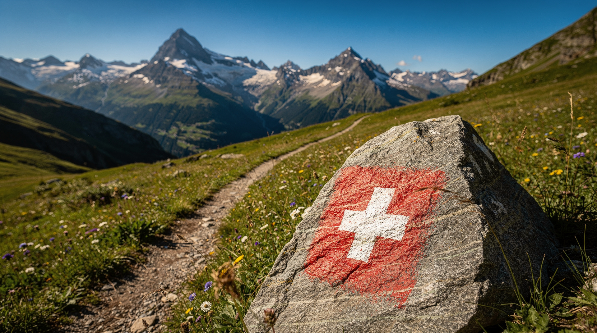
Use the lift infrastructure. Switzerland’s cable cars and funiculars are designed precisely to give walkers access to high terrain without the effort of a multi-hour ascent. The Swiss Travel Pass gives significant discounts on many of these, and some are fully included.
Go early. Easy and accessible hikes attract large numbers of visitors on summer weekends. Arriving at the cable car station before 09:00 gives you the best of the trail before the crowds, the best light for photography, and the calmest water for lake reflections.
Weather is unpredictable. Even on an easy walk at altitude, conditions can change rapidly. Always carry a light rain layer and an extra warm layer regardless of the morning forecast.
Footwear matters. Trail shoes with grip and ankle support are appropriate for all routes listed here. Trainers or sandals are not suitable for any trail above the valley floor, regardless of how well-maintained it appears.
For hiking with children, the Lauterbrunnen hikes guide covers specifically family-friendly trails in one of Switzerland’s most dramatic valleys. The family activities guide covers the wider context of Swiss mountain experiences with children. For adventure hiking, the multi-day treks guide covers the classic long-distance routes.
Combining easy hikes with other Swiss experiences
The best easy hikes in Switzerland are designed to complement broader itineraries rather than occupy full days in isolation. Several of the routes above naturally pair with other activities:
Lavaux + lake cruise: The Lavaux vineyard trail ends in Vevey, from where lake boats run to Lausanne and Geneva in one direction and to Montreux and Chillon Castle in the other. The Chateau de Chillon is a 10-minute ferry ride from Montreux. An afternoon at Chillon after a morning on the Lavaux terrace makes a compelling day in the Lake Geneva region.
Bachalpsee + First adventure activities: The Grindelwald First cable car gives access to both the Bachalpsee hike and the First Flyer, First Glider, and Mountain Cart activities. Younger hikers can do the lake walk while older family members ride the zip line, then reunite for lunch at the First restaurant. The adventure parks guide covers the First activities in detail.
Oeschinensee + Kandersteg thermal bath: Kandersteg has a modest but pleasant thermal indoor pool (Sportbad Kandersteg) that provides excellent post-hike recovery. The combination of the Oeschinensee in the morning and a warm pool in the afternoon is a satisfying day structure.
Rigi + lake steamer: The steamer from Lucerne to Vitznau for the rack railway, the Rigi circuit walk, descent to Weggis on foot or cable car, and return by steamer to Lucerne covers all of the iconic central Swiss tourist elements in a single day without feeling rushed.
What makes Swiss easy hikes genuinely easy
A clarification worth making: Switzerland’s trail-marking system designates routes by colour and mountain category rather than by difficulty metrics like gradient or terrain type in isolation. A “yellow” (easy) Swiss trail can involve significant elevation changes — up to 400-500 metres of ascent — that would be classified as moderate or demanding in countries with gentler criteria.
The routes in this guide are selected specifically because they deliver exceptional views and experiences with minimal elevation demands. The defining criterion is that the lift or transport does the ascending work, and the walking itself is relatively flat or gently graded once you arrive. This is genuinely different from Swiss hiking’s general easy category, which includes substantial climbs.
For walkers with mobility limitations, some routes are more accessible than others. The Männlichen to Kleine Scheidegg trail is the most universally accessible — largely flat, on a wide maintained path, with no steps or rough sections. The Rigi circuit between Rigi-Kulm and Rigi-Staffel is also very manageable. The Lavaux vineyard trail involves more ascent and descent between terraces and is less suitable for those with knee or ankle issues.
Booking mountain transport in advance
Several of the transport connections used to start the hikes in this guide benefit from advance booking, particularly in peak season (July and August):
Grindelwald First cable car: Book online via the Jungfrau Railway website for guaranteed access. Summer weekends see queues of 45-90 minutes at the cable car base.
Zermatt lift system: The Sunnegga underground funicular for the Five Lakes Walk runs frequently; queues are rarely excessive but can build on clear summer mornings.
Gornergrat Railway: Advance booking recommended for seats with mountain-facing views. The railway is very busy in summer.
Männlichen gondola from Grindelwald: No booking required; the gondola runs continuously on a wide cabin system. Occasional maintenance closures — check the Jungfrau Railways website status page.
The Swiss Travel Pass covers transport to the valley stations (train and PostBus) for all routes in this guide. Cable car and funicular surcharges are additional but typically 25-50 percent discounted for pass holders.
Photography on easy Alpine hikes
Switzerland’s easy hikes deliver some of the most photographable mountain scenery in the world, and several practical points improve results:
Golden hour: The Matterhorn reflections at Riffelsee on the Five Lakes Walk are most dramatic in early morning when the peak catches the first light. The Bachalpsee reflections require calm water — typically before 09:00 or in the evening. Plan accordingly.
Cloud inversion: Valley fog below a mountain platform is a stunning photographic phenomenon. Arriving at altitude to find a sea of cloud below, with peaks emerging above, requires an early start and a willingness to ascend on faith that conditions above the fog are clear. The Rigi and Muottas Muragl are reliably above winter valley fog.
Lens choice: A wide-angle lens (24-35mm equivalent) handles the scale of Swiss mountain scenery better than telephoto. For the Matterhorn reflection shots at Riffelsee, a wider aperture and fast shutter speed in low morning light is the technical priority.
Camera phone considerations: Modern smartphones at equivalent to f/2.8 wide angle capture excellent Swiss mountain scenery in good light. For sunrise and low-light conditions, a mirrorless camera with a fast prime lens adds meaningfully to the result.